Wetland Identification Program
The Wetland Identification Program assists landowners to determine if wetlands are present on their property. Please contact DNR Wetland ID staff to determine if the Identification Service or Confirmation Service are necessary for your project.
How to Identify Wetlands
If your property is in a low area, has standing water for part of the year, and has common wetland plants such as cattails, reed canary grass, sedges, alder, or willow, you likely have wetlands. Be aware that areas that are dry most of the time may still be wetlands.
Using the DNR Surface Water Data Viewer:
- Zoom in to the property or project area.
- Click "Show Layers" in the upper left.
- Turn on the "Mapped Wetlands" layer, which will show existing wetlands.
- Turn off the "Mapped Wetlands" layer.
- Turn on the "Wetland Indicators and Soils" layer, which will show the extent of potential wetlands.
*If these maps do not show wetlands or wetland indicators on the property, there may still be wetlands present.
DNR Wetland Identification Service
Used For: Project planning and wetland presence/absence.
Not Suited For: Projects that have wetland setback requirements or that are located very close to a wetland. These likely require a full wetland delineation for permitting purposes.
Includes:
- an on-site inspection by DNR Wetland ID staff to determine if wetlands exist.
- a survey of up to 5 acres for a fee of $300 per acre.
- a presence/absence determination and/or an approximate wetland boundary location.
- a response in 60 days or less.
Wetland Delineation
Required For: All development projects that may result in impacts to wetlands, including general permit submittals and individual permit submittals. A delineation is also strongly recommended for wetland exemption notifications.
Includes: A precise wetland boundary survey that meets federal and state regulations.
Completed By: Wetland professionals. See wetland delineation for more details.
*DNR does not complete wetland delineations but confirms their accuracy.
DNR Wetland Confirmation Service
Required for: All wetland delineations, however a Wetland Confirmation is not required if your delineation was completed by a DNR Assured Wetland Delineator.
Includes:
- an on-site property inspection during the growing season to confirm delineation accuracy.
- a survey of any size parcel, for $300 per 20 acres of land reviewed.
- a written statement of confirmation.
- a response in 60 days or less.
Planning Notes: The goal of this service is to provide landowners and developers with certainty that delineated wetland boundaries are accurate before project plans are finalized. DNR recommends requesting a Wetland Confirmation early in the planning phase to prevent unexpected wetland boundary concerns from delaying project approval.
For Nonfederal Wetlands: Wetland delineations for nonfederal wetlands may be eligible for a nonfederal confirmation that is typically valid for 15 years. A jurisdictional determination is required from the U.S. Army Corps of Engineers before submitting a nonfederal confirmation request. Assured delineations require a nonfederal confirmation determination through the DNR in order to be valid for 15 years.
Service Requests
Submit a Wetland Identification Service Request
- Go to the Wisconsin DNR ePermitting system. A WAMS ID is required for login.
- Click on "Wetland Identification" on the left side menu.
- Select "Wetland Identification Request" in the wetland ID activity box.
- Complete and submit the request.
Submit a Wetland Confirmation Service Request
- Go to the Wisconsin DNR ePermitting system. A WAMS ID is required for login.
- Click on "Wetland Identification" on the left side menu.
- Select "Wetland Delineation Confirmation Requests" in the wetland ID activity box.
- Complete and submit the request.
*See Non-Growing Season Determinations for service requests outside of the growing season.
Fees: see permit fee sheet for clarification on wetland ID service fees.
Wetland FAQ
- Are there wetlands on a property I am interested in purchasing?
-
Using the DNR Surface Water Data Viewer:
- Zoom in to the property
- Click "Show Layers" in the upper left
- Turn on the "Mapped Wetlands" layer, which will show existing wetlands
- Turn off the "Mapped Wetlands" layer
- Turn on the "Wetland Indicators and Soils" layer, which will show the extent of potential wetlands
If these maps do not show wetlands or wetland indicators on the property, there may still be wetlands present. Use the DNR Wetland Identification Service to determine presence/absence before you complete a project.
For those making an offer on a property, the Wetlands Real Estate Addendum may be used to verify the presence of wetlands during the purchase negotiations, reducing risk to buyers.
- How do I find out if my property has wetlands and needs a permit?
-
For future project planning and upland determination purposes, use the DNR Wetland Identification Service to obtain a presence/absence statement and an approximate wetland boundary.
You can also use map tools and survey your own property to gain a sense of wetland extent first. You can also consult a professional wetland delineator. See resources on our Wetland Delineation page for details on how to do so.
If you are planning a project on land with wetlands, a DNR wetland permit may be required.
- What is a wetland delineation and do I need one?
-
A wetland delineation is a precise wetland boundary survey that meets federal and state regulations and is completed by a wetland professional. It is required for all development projects that may result in impacts to wetlands, including wetland exemptions, general permit submittals, and individual permit submittals.
- What are my permitting options?
-
See Wetland Permitting Process to review eligibility criteria for exemptions and general permits, requirements for submittals, and what to expect for timelines.
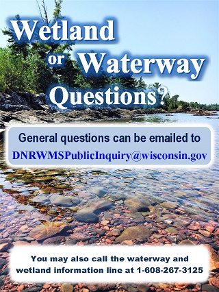
Contact information
For more information on wetland boundary delineation, contact the specialist for your county:
- Wetland delineation specialists
-