Property Planning Viewer

The Property Planning Viewer is an interactive web mapping application designed to aid the planning process of properties managed by Wisconsin DNR. It uses map “themes” to show the traditional master planning map series — for example, DNR and Other Lands, Land Management Classifications, and Existing Road Infrastructure.
The Property Planning Viewer can be used to gain a general overview of a region or to find detailed information about specific DNR properties. You can also do basic spatial analyses with the Measure and Buffer tools, add markup to the map or print off a custom detailed map of your subject area. Instructions on how to do all this are provided in a user guide accessible from within the viewer.
The Property Planning Viewer displays map layers specific to the master planning process. Visit the Public Access Lands viewer for information on open public lands and recreational opportunities, or view the list of all DNR web viewers.
Launch the Property Planning Viewer web mapping application.
Map themes
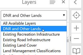
The Property Planning Viewer has multiple Map Themes corresponding to traditional master planning maps. The default theme is “DNR and Other Lands,” but you can switch among the different themes at any time during your session. There is also an “All Available Layers” theme where you can customize your map by turning on any combination of data layers you want to view.
Explore the available themes below.
- DNR and Other Lands
-
The DNR and Other Lands theme highlights land ownership. This includes DNR owned lands such as state parks, state forests, wildlife areas, fishery areas and state natural areas. It also includes other lands open to the public such as national forests, county forests and stewardship grant lands.
Note: Not all lands shown in the Property Planning Viewer are open to the public. Users should consult the map legend for differentiation of open and closed areas.
Launch the DNR and Other Lands theme.
- Existing Recreation Infrastructure
-
This theme contains existing infrastructure features on DNR properties related to recreation. Types of features include trails, bridges, boat access sites, parking lots and DNR roads open for motorized access. For more information and maps of additional recreation features at DNR state parks, forests, recreation areas or trails, visit the Wisconsin State Park System site.
Note: This theme only contains features contained within DNR’s enterprise GIS databases. Updates to these data sets are ongoing.
Launch the Existing Recreation Infrastructure theme.
- Existing Road Infrastructure
-
This theme shows all existing roads on DNR properties categorized according to the types defined in Wisconsin Administrative Code NR 44.07: primitive, lightly developed, moderately developed and fully developed.
Note: Not all roads in the Property Planning Viewer are open to the public for the use of motorized vehicles. Users should consult the map legend for differentiation of open, open seasonally and closed roads.
Launch the Existing Road Infrastructure theme.
- Existing Land Cover
-
The Existing Land Cover theme contains land cover information on DNR land. Land cover information is derived from the DNR Forestry Division’s Wisconsin Forest Inventory and Reporting System (WisFIRS) dataset. WisFIRS land cover designations have been generalized into broader habitat management classifications for the master planning process.
Launch the Existing Land Cover theme.
- Land Management Classifications
-
This theme contains land management classifications for DNR land with NR 44 compliant master plans. Land management classifications describe the general management objective for a property or a management area within a property as determined during the master planning process.
Management classifications are those defined in Wisconsin Administrative Code NR 44.06.
Launch the Land Management Classifications theme.
- Real Estate Action Items
-
The Real Estate Action Items theme contains layers related to real estate adjustments being proposed as part of a master plan, such as a parcel redesignation or a project boundary expansion or contraction.
Launch the Real Estate Action Items theme.
Disclaimer
The Wisconsin Department of Natural Resources seeks to provide access to the best statewide map information available to the DNR for use in public services.
The Property Planning Viewer contains the best available information about DNR properties, private lands under DNR management and features associated with these lands. Updates to these data sets are ongoing.
The information shown on these maps has been obtained from various sources and are of varying age, reliability and resolution. These maps are not intended to be used for navigation, nor are they an authoritative source of information about legal land ownership or public access. Users of these maps should confirm the ownership of land through other means in order to avoid trespassing. No warranty, expressed or implied, is made regarding accuracy, applicability for a particular use, completeness or legality of the information depicted on this map.
NOTE: Not all lands shown in the Property Planning Viewer are open to the public. Users should consult the map legend for differentiation of open and closed areas.
NOTE: Project boundaries are established areas on the landscape, created by a Natural Resources Board action, where the department may acquire land. The department acquires land from willing sellers only.
For additional information, see the DNR Terms and Conditions or contact DNR customer service.