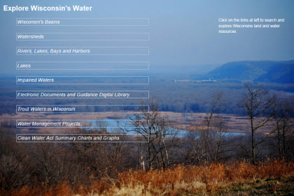
Clean Water Act Water Quality Plans and Reports
Targeted Assessments of Wisconsin Water Resources
- Subscribe to receive updates on WQM planning.
Wisconsin's Clean Water Act water quality plans are published on an ongoing basis. Year 2020 plans listed below are final and approved. A list of reports scheduled for 2021 publication will be available shortly.
To learn more about a specific project or to get involved in your watershed, contact your local water quality program office.
2020 WQM plans
About the planning process
About water quality plans
- About Wisconsin's Year 2020 TWA WQ Plans & Reports [PDF]
- Legal framework for WQM plans
- Overview of water resources programs [PDF]
- Targeted watershed approach monitoring projects [PDF]
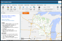
Search waters and projects
EPA-certified WQ plans
| 2017 WQM plans | ||||
|---|---|---|---|---|
| Targeted Watershed Approach (TWA) Monitoring Project | Summary Findings [PDF] | WQM Plan [PDF] | WQM Plan Online | Watershed Online |
| Big-Douglas & Rathbone Soper Creeks | Summary | WQM Plan | Plan | BR03 |
| Big Green Lake | Summary | WQM Plan | Plan | UF07 |
| Fond du Lac | Summary | WQM Plan | Plan | UF03 |
| Hillsboro Lake | Summary | WQM Plan | Plan | LW24 |
| Lower Little Wolf | Summary | WQM Plan | Plan | WR06 |
| Lower Peshtigo | Summary | WQM Plan | Plan | GB07 |
| Pine & Calvin Cr Frontal L Michigan | Summary | WQM Plan | Plan | MA01 |
| Rocky Run, E. Fk. Chipp Muskellunge | Summary | WQM Plan | Plan | UC21 |
| Sauk Creek | Summary | WQM Plan | Plan | SH01 |
| Taylor Creek Sugar River | Summary | WQM Plan | Plan | SP11 |
| Wolf Creek | Summary | WQM Plan | Plan | GB13 |
| Mineral Point Branch | Summary | WQM Plan | Plan | SP09 |
| North Branch Beaver Creek | Summary | WQM Plan | Plan | GB08 |
| Oak Creek-Frontal L. Michigan | Summary | WQM Plan | Plan | SE05 |
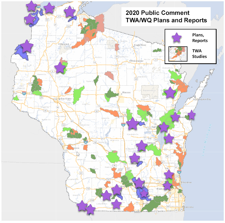
TWA plan locations
Wisconsin targeted assessment water quality plan locations
The first of three sets of plans for review are located in blue below. The numbers on these plans correspond to watersheds with public review drafts posted in the 2020 WQM Plans tab.
Learn more about the state’s ongoing TWA studies.
TWA approach
Targeted watershed approach - streams, lakes, wetlands and more
TWA monitoring provides a rotating watershed approach for baseline data collection that blends baseline work with targeted and effectiveness monitoring.
Monitoring Objectives
The goal of targeted watershed assessments across lakes, streams, and wetlands is to identify attainment status and changes in water quality in response to land management practices. Initially, the focus of monitoring will be on streams, but lakes and wetlands will also be monitored in some targeted watersheds. The Targeted watershed approach aligns resource monitoring by watershed at HUC 12 or HUC 10 scale. The design is a rotation approach and its value is enhanced through alignment with fisheries monitoring. An additional value of this type of monitoring is the prospect of aligning volunteer monitoring with staff work to fill in gaps (spatial, temporal), conduct follow-up monitoring (TP sampling, AIS monitoring), collect strategic data (such as near permit outfalls, etc.) and to gather data that results in prioritization of new sites based on results. This approach can involve alignment and sequencing of monitoring, assessment, planning, implementation (i.e. watershed planning framework).
Monitoring Design
The TWA design involves monitoring at the HUC 12 scale (~29-mi2). Approximately five to six sites may be sampled per watershed (HUC 12) (1 site/5-mi2), at which chemistry, macroinvertebrates, fish, habitat, and flows/water levels. These core indicators will be supplemented by intensification areas at pour point including six grabs samples, one per month from May through October. Lakes will also be monitored in the Targeted Watershed when nutrient loading is a concern and/or when land management practices are in play. Water quality issues in lakes will often drive the interest in monitoring the condition of streams in the watershed and TWAs will integrate these two waterbody types.
Site Selection and Design
Stream monitoring locations were selected from a dataset of previously monitored reference sites and by best professional judgment. Although sites are meant to represent least-disturbed conditions because of the non-uniform distribution of land uses within the State the amount of agriculture and urban land uses in a specific reference watershed may vary across the State.
Monitoring for the Wadeable Trend Reference Sites requires multiple site visits to sample during the appropriate index periods. Temperature loggers should be deployed in spring as soon as the water levels are safe to work and removed in fall. Fish, chemical, physical habitat and flow monitoring should take place during the fish sampling summer index period avoiding recent rainfalls. The macroinvertebrate monitoring should occur during the fall sampling index period.
Water Quality Indicators
Targeted watershed approach indicators:
| Parameter | Analysis location | Database | Assessment indicator |
|---|---|---|---|
| Chemistry Data | State Laboratory of Hygiene | Horizon (SLOH) to LDES to SWIMS | TP package, chlorides package, and other (WisCALM assessment) |
| Macroinvertebrate IBI substrate sample | UW Stevens Point Entomology Laboratory | UWSP to SWIMS | Wadeable macroinvertebrate index (WisCALM assessment) |
| Physical parameters | In-field | Fish database or SWIMS | Physical (flow) data |
| Fish electroshock - fish species present, count | In-field and fish database | Fisheries database | Fish IBI (dependent on natural community). (WisCALM assessment) |
| Habitat (qualitative) metrics | In-field and fish database | Fisheries database | Habitat suitability index |
Quality Assurance
- Field protocols
- In field Quality Assurance during data collection
- Sampling & transmittal procedures
- UWSP QA Processes
- SLOH QA Processes
- SWIMS Data flow QA checks
- SWIMS Data Management Checks
- Fish DB Data Quality Checks
Data Management
Field data is directly entered into the SWIMS system. Each HUC will be developed as its own "project" in the SWIMS system (data management design) and under each project fieldwork events with laboratory and field data are collected. Project set up and station creation is conducted in SWIMS by Rivers and Streams Program Coordinator or the SWIMS file manager. Field data is entered subsequent to the field data collection. The data entry into SWIMS follows the generation of labslips and the establishment of fieldwork events. Most analytical work is conducted at the State Laboratory of Hygiene and transmitted through the LDES to the SWIMs system.
Fisheries and habitat data is entered directly into the USGS supported Fisheries Database. Macroinvertebrate data is collected in the field and transmitted to the UWSP Entomology Laboratory for analysis. This data is then entered into a local computer and send to a contractor for the SWIMS system where it is entered into the SWIMS system and metrics are created. Currently, SWIMS does not store aquatic plant, habitat, sediment core, and water budget data on lakes. Plans to store aquatic plant and lake habitat data in SWIMS are under development.
Reporting
Collected data will be summarized on a biennial basis for the purpose of reporting on the status of the state's waters for the Integrated Water Quality Report to Congress (every two years). The data will also be used for key parameter package analyses and statewide condition summaries. Of critical importance, all data from the Targeted Watershed Assessments (TWA) work will be rolled into the watershed planning assessments, narrative descriptions and recommendations will be entered and archived in the WATERS data on an ongoing basis. Biologists are responsible for completing reports for each Targeted Watershed on a schedule created by regional and central office.
Programmatic Evaluation
Periodic reviews to this study design will be made at two- and five-year intervals to determine if additional sites or subsequent monitoring is needed.