White Cliff Fen And Forest
No. 383
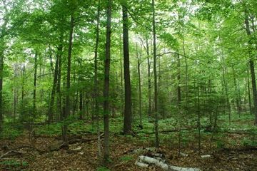 Photo by Josh Mayer
White Cliff Fen and Forest features a deep, undisturbed forest of white cedar and hardwoods surrounding a calcareous fen that rests at the base of the Niagara escarpment. The area lies less than ½ mile from Green Bay. The fen is fed by alkaline groundwater rich in calcium and magnesium bicarbonates and is dominated by woolly-fruit sedge and hard-stem bulrush. Plant species include such fen indicators as Kalm's lobelia, boneset, marsh fern, and common bog-arrow grass. Other plants are marsh marigold, small-flowered false foxglove, northern bog goldenrod, and northern bog aster. Marsh milkweed is plentiful throughout the wetland and attracts numerous nectaring butterflies including a large number of monarchs.
Limestone bedrock is exposed in areas of the fen, an indicator of a very shallow peat layer. An irregular, narrow border of shrubby cinquefoil, small white cedar, red-osier dogwood, alder-leaf buckthorn, and tamarack rings the fen. The area slowly grades into a white cedar and green ash woodland and then into an upland forest of white cedar, hemlock, red oak, big-tooth aspen, and white ash. Other trees include paper birch, beech, sugar maple, white pine, white spruce, and red pine. Although rare plant and animal surveys are pending, the surrounding area contains three rare land snails and a rare dragonfly. Future inventories may reveal the presence of these and other rare species at this site. White Cliff Fen and Forest is owned by the Door County Land Trust and was designated a State Natural Area in 2002.
Very few State Natural Areas have public facilities, but nearly all are open for various recreational activities as indicated below. Generally, there are no picnic areas, restrooms, or other developments. Parking lots or designated parking areas are noted on individual SNA pages and maps. Trails, if present, are typically undesignated footpaths. If a developed trail is present, it will normally be noted on the SNA map and/or under the Maps tab. A compass and topographic map or a GPS unit are useful tools for exploring larger, isolated SNAs.
The good majority of SNAs are isolated and have few or no facilities. Some SNAs have vehicle access lanes or parking lots, but their accessibility may vary depending on weather conditions. Parking lots and lanes are not plowed during winter. Hiking trails may be nonexistent or consist of undeveloped footpaths. A GPS unit or compass and a detailed topographic map are useful tools for exploring larger SNAs.
Non-DNR lands
Entrance fees: For non-DNR-owned SNAs, we are unaware of any vehicle or admission fees. However, please contact the landowner for more information.
Hunting and trapping
This is a non-DNR-owned SNA: Opportunities for hunting and trapping depend on the landowner. Please contact them directly to find out about their rules for hunting and trapping. You can find a link to other owner websites under the Resources tab.
For hunting opportunities, visit the Door County Land Trust [exit DNR].
Other activities
Other allowable activities such as - but not limited to camping, geocaching and bicycling are determined by the landowner. Please contact them directly or visit their websites for details.
Location
Door County. T30N-R27E, Sections 13, 18. 100 acres.
Driving directions
From Egg Harbor, go east on Horseshoe Bay Road for 0.8 miles, then north on Dock Road for 0.2 miles, and continue north on White Cliff Road for 2.1 miles to the trailhead located south of the road. Parking is available at the public boat launch immediately east of the trailhead.
The DNR's state natural areas program is comprised of lands owned by the state, private conservation organizations, municipalities, other governmental agencies, educational institutions and private individuals. While the majority of SNAs are open to the public, access may vary according to individual ownership policies. Public use restrictions may apply due to public safety, or to protect endangered or threatened species or unique natural features. Lands may be temporarily closed due to specific management activities. Users are encouraged to contact the landowner for more specific details.
The data shown on these maps have been obtained from various sources, and are of varying age, reliability, and resolution. The data may contain errors or omissions and should not be interpreted as a legal representation of legal ownership boundaries.
To create your custom map where you can zoom to a specific location, please use the DNR's mapping application.
White Cliff Fen And Forest is owned by: Door County Land Trust