Wheeler Lake
No. 456
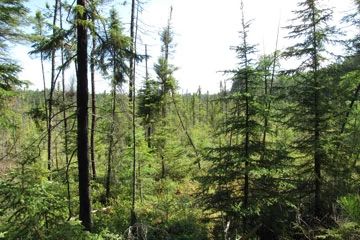 Photo by U.S. Forest Service
Wheeler Lake contains a wetland complex with several scattered stands of older-growth hemlock and fire-origin red pine. The site is remote, poorly roaded, and adjacent to the Goodman tract. The pine is found on upland islands and peninsulas on the western end of the site. Scattered throughout are upland white cedar and black spruce with an occasional large diameter white spruce. Wheeler Lake is a shallow bog lake and contains a black tern colony, common loons, and gray jays. The higher quality stands of northern dry and dry-mesic forests are fire-origin red pine. The oldest trees appear to be about 85 years old with the stand records indicating origin dates of 1920, 1922, 1929, and 1937. The understory is generally open with scattered bracken fern, bunchberry, spinulose wood fern, and wild sarsaparilla. There is little to no pine regeneration. Trembling aspen dominates sites with a more recent history of clear cutting.
Hemlock and older-growth hardwoods including sugar maple and yellow birch dominate the northern mesic forest. Other communities include open bog dominated by sphagnum, leather-leaf, American woolly-fruit sedge, and few-seeded sedge; alder thicket; and northern sedge meadow dominated by tussock sedge and blue joint grass. Wheeler Lake is a 44-acre shallow, medium hard-water drained lake surrounded by wetlands grading from open bog to emergent aquatic to northern wet forest. Bird life includes a black tern colony, common loon, and gray jay. Common plant species within and surrounding the lake include white water-lily, yellow water-lily, broad-leaved cat-tail, spotted joe-pye weed, northern blue flag iris, bladderworts, and pondweeds. Wheeler Lake is owned by the US Forest Service and was designated a State Natural Area in 2007.
Very few State Natural Areas have public facilities, but nearly all are open for various recreational activities as indicated below. Generally, there are no picnic areas, restrooms, or other developments. Parking lots or designated parking areas are noted on individual SNA pages and maps. Trails, if present, are typically undesignated footpaths. If a developed trail is present, it will normally be noted on the SNA map and/or under the Maps tab. A compass and topographic map or a GPS unit are useful tools for exploring larger, isolated SNAs.
The good majority of SNAs are isolated and have few or no facilities. Some SNAs have vehicle access lanes or parking lots, but their accessibility may vary depending on weather conditions. Parking lots and lanes are not plowed during winter. Hiking trails may be nonexistent or consist of undeveloped footpaths. A GPS unit or compass and a detailed topographic map are useful tools for exploring larger SNAs.
Non-DNR lands
Entrance fees: For non-DNR-owned SNAs, we are unaware of any vehicle or admission fees. However, please contact the landowner for more information.
Hunting and trapping
Other activities
Other allowable activities such as - but not limited to camping, geocaching and bicycling are determined by the landowner. Please contact them directly or visit their websites for details.
Location
Within the Chequamegon-Nicolet National Forest. Florence County. T38N-R16E, Sections 4, 5, 7, 8, 9, 17. 769 acres.
Driving directions
From the intersection of FR 2156 and Highway 139 in Long Lake, go south on 139 for 3.4 miles, then east on FR 2161 for approximately 8.6 miles, then north on 2872 for about 2.2 miles into the site.
The DNR's state natural areas program is comprised of lands owned by the state, private conservation organizations, municipalities, other governmental agencies, educational institutions and private individuals. While the majority of SNAs are open to the public, access may vary according to individual ownership policies. Public use restrictions may apply due to public safety, or to protect endangered or threatened species or unique natural features. Lands may be temporarily closed due to specific management activities. Users are encouraged to contact the landowner for more specific details.
The data shown on these maps have been obtained from various sources, and are of varying age, reliability, and resolution. The data may contain errors or omissions and should not be interpreted as a legal representation of legal ownership boundaries.
To create your custom map where you can zoom to a specific location, please use the DNR's mapping application.
Wheeler Lake is owned by: U.S. Forest Service