Twin Lakes Bog
No. 297
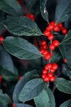 Photo by E. Judziewicz
Twin Lakes Bog features an undisturbed conifer swamp occupying a depression between two kettle lakes in an area of morainal topography. The swamp is dominated by tamarack with black spruce, red maple, and yellow birch. The understory has an open aspect with characteristic bog shrubs and herbs scattered on a mat of Sphagnum moss. Dominant shrubs are Labrador tea, bog laurel, and leather-leaf with mountain holly, and winterberry. The sphagnum mat contains several sedge species including two-seeded bog sedge and American woolly-fruit sedge with twinflower, cinnamon fern, bunchberry, and buckbean. Insectivorous plants are well represented with bladderwort, sundews, and pitcher plants. The understory is also notable for a large number of moccasin flowers.
Three small bog lakes, surrounded by quaking bogs, complement the site. Also present is a small stand of second-growth northern hardwoods dominated by sugar maple and red oak, which surrounds the uplands to the west. Birds include blue-headed vireo, hermit thrush, black-and-white warbler, and white-throated sparrow. Twin Lakes Bog is owned by the U.S. Forest Service and was designated a State Natural Area in 1996. This site is also recognized by the Forest Service as an established Research Natural Area.
Very few State Natural Areas have public facilities, but nearly all are open for a variety of recreational activities as indicated below. Generally, there are no picnic areas, restrooms, or other developments. Parking lots or designated parking areas are noted on individual SNA pages and maps. If a developed trail is present, it will normally be noted on the SNA map and/or under the Maps tab. A compass and topographic map or a GPS unit are useful tools for exploring larger, isolated SNAs.
The good majority of SNAs are isolated and have few or no facilities. Some SNAs have vehicle access lanes or parking lots, but their accessibility may vary depending on weather conditions. Parking lots and lanes are not plowed during winter. Hiking trails may be nonexistent or consist of undeveloped footpaths. A GPS unit or compass and a detailed topographic map are useful tools for exploring larger SNAs.
Non-DNR lands
Entrance fees: For non-DNR-owned SNAs, we are unaware of any vehicle or admission fees. However, please contact the landowner for more information.
Hunting and trapping
Other activities
Other allowable activities such as - but not limited to camping, geocaching and bicycling are determined by the landowner. Please contact them directly or visit their websites for details.
Location
Within Chequamegon-Nicolet National Forest, Taylor County. T32N-R1W, Section 1 S½SE¼. 38 acres.
Driving directions
From the intersection of State Highways 64 and 13 in Medford, go north on Highway 13 for 9.8 miles, then west on Cemetery Avenue for 0.5 miles, then north on 4th Street for 0.5 miles, then west on FR 102 (Quarter Lane) for 2.9 miles, then north on FR 101 0.5 miles, then west again on FR 102 (Mondeaux Avenue) 4.2 miles, then south on FR 566 (Twin Lakes Road) 0.75 mile, then southeast on FR 1504 0.25 mile to the western boundary of the site.
The DNR's state natural areas program is comprised of lands owned by the state, private conservation organizations, municipalities, other governmental agencies, educational institutions and private individuals. While the majority of SNAs are open to the public, access may vary according to individual ownership policies. Public use restrictions may apply due to public safety, or to protect endangered or threatened species or unique natural features. Lands may be temporarily closed due to specific management activities. Users are encouraged to contact the landowner for more specific details.
The data shown on these maps have been obtained from various sources, and are of varying age, reliability, and resolution. The data may contain errors or omissions and should not be interpreted as a legal representation of legal ownership boundaries.
To create your custom map where you can zoom to a specific location, please use the DNR's mapping application.
Twin Lakes Bog is owned by: U.S. Forest Service