Riveredge Creek and Ephemeral Pond
No. 197
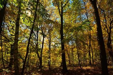
Photo by Joshua Mayer
Riveredge Creek and Ephemeral Pond contain a slow, cold, hard water stream of exceptionally high water quality which supports a stable, diverse invertebrate community. Riveredge Creek's upper reach, consisting of three branches, has an invertebrate fauna dominated by the caddisfly (Molanna); the lower reach is dominated by Glossoma; and the middle reach exhibits a diverse, extremely well-balanced fauna including at least five other species of caddisfly, stoneflies, mayflies, beetles, true bugs, flies (including blackflies), scuds, aquatic sow bug, and snails.
This aquatic assemblage appears to be stable. The leaf litter is well processed, reflecting the productivity of shredders. The stream has a flow of 4 cfs, a dissolved oxygen content of 12 ppm, and a temperature not known to exceed 65F. Two fen-like areas are associated with this complex. The forest is second-growth northern wet-mesic. The ephemeral pond is rich in plant and animal species including caddisflies, fairy shrimp, predacious diving beetles, backswimmers, and Diptera. The pond shrinks annually but dries up completely only during extreme droughts. Riveredge Creek and Ephemeral Pond is owned by Riveredge Nature Center, Inc (a nonprofit, privately owned environmental education facility) and was designated a State Natural Area in 1985.
Very few State Natural Areas have public facilities, but nearly all are open for various recreational activities as indicated below. Generally, there are no picnic areas, restrooms, or other developments. Parking lots or designated parking areas are noted on individual SNA pages and maps. If a developed trail is present, it will normally be noted on the SNA map and/or under the Maps tab. A compass and topographic map or a GPS unit are useful tools for exploring larger, isolated SNAs.
The good majority of SNAs are isolated and have few or no facilities. Some SNAs have vehicle access lanes or parking lots, but their accessibility may vary depending on weather conditions. Parking lots and lanes are not plowed during winter. Hiking trails may be nonexistent or consist of undeveloped footpaths. A GPS unit or compass and a detailed topographic map are useful tools for exploring larger SNAs.
Non-DNR lands
Entrance fees: For non-DNR-owned SNAs, we are unaware of any vehicle or admission fees. However, please contact the landowner for more information.
Hunting and trapping
Other activities
Other allowable activities such as - but not limited to camping, geocaching and bicycling are determined by the landowner. Please contact them directly or visit their websites for details.
Location
Ozaukee County. T11N-R21E, Sections 6, 7, 8. 61 acres.
Driving directions
From Newburg, go east on County Highway Y 1 mile to the east parking lot. Check-in at the Riveredge Nature Center office. A one-time membership fee is charged. Visitors must stay on the trails.
The DNR's state natural areas program is comprised of lands owned by the state, private conservation organizations, municipalities, other governmental agencies, educational institutions and private individuals. While the majority of SNAs are open to the public, access may vary according to individual ownership policies. Public use restrictions may apply due to public safety, or to protect endangered or threatened species or unique natural features. Lands may be temporarily closed due to specific management activities.
Users are encouraged to contact the landowner for more specific details. The data shown on these maps have been obtained from various sources, and are of varying age, reliability, and resolution. The data may contain errors or omissions and should not be interpreted as a legal representation of legal ownership boundaries. To create your custom map where you can zoom to a specific location, please use the DNR's Mapping Application.
Riveredge Creek & Ephemeral Pond is owned by: Riveredge Nature Center