Pat Shay Lake
No. 446
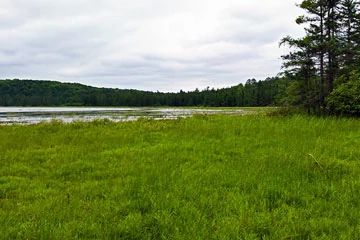
Photo by Aaron Carlson
Pat Shay Lake features a high-quality wild lake surrounded by excellent old-growth hemlock-hardwood forests, rare in the National Forest on this LTA. Hemlock is regenerating well in canopy gaps and around the stand margins. Immediately north and south of the lake are forests dominated by hemlock with a minor component of sugar maple and yellow birch. Northwest of Pat Shay Lake, sugar maple becomes co-dominant with hemlock. Trees up to 24 inches in diameter are present for both species. The best stands have good old-growth characteristics including den trees, large snags, and downed coarse woody debris throughout. The herb layer is dominated by Dryopteris fern species and lycopods.
The topography of the uplands is generally rolling with steep slopes bordering the wetlands. In the western half of the complex, a good quality bog pond community and a good quality sedge meadow are divided by a representative early successional stage forest community. Scattered super-canopy white pine is present. The site contains no improved roads, only skidder trails, ski trails, and an access trail to Pat Shay Lake. Rare and uncommon birds include gray jay, black-throated blue warbler, and Nashville warbler. Other notable species are lance-leaved grape fern, least moonwort, and checkered rattlesnake plantain. Pat Shay Lake is owned by the US Forest Service and was designated a State Natural Area in 2007.
Very few State Natural Areas have public facilities, but nearly all are open for various recreational activities as indicated below. Generally, there are no picnic areas, restrooms, or other developments. Parking lots or designated parking areas are noted on individual SNA pages and maps. If a developed trail is present, it will normally be noted on the SNA map and/or under the Maps tab. A compass and topographic map or a GPS unit are useful tools for exploring larger, isolated SNAs.
The good majority of SNAs are isolated and have few or no facilities. Some SNAs have vehicle access lanes or parking lots, but their accessibility may vary depending on weather conditions. Parking lots and lanes are not plowed during winter. Hiking trails may be nonexistent or consist of undeveloped footpaths. A GPS unit or compass and a detailed topographic map are useful tools for exploring larger SNAs.
Non-DNR lands
Entrance fees: For non-DNR-owned SNAs, we are unaware of any vehicle or admission fees. However, please contact the landowner for more information.
Hunting and trapping
Other activities
Other allowable activities such as - but not limited to camping, geocaching and bicycling are determined by the landowner. Please contact them directly or visit their websites for details.
Location
Located within the Chequamegon-Nicolet National Forest. Forest, Oneida, and Vilas Counties. T39N-R11, Section 1. T39N-R12E Sections 5, 6. T40N-R12E Section 29, 30, 31. T40N-R11E Section 36. 736 acres.
Driving directions
The site is located approximately 13 miles Southeast of Eagle River. Go south on FR 2178 for 3 miles, then east on FR 2179 for 1 mile. An unimproved dirt road provides access to the Southeast corner of Pat Shay Lake for canoe access. Ski trails enter the north end of the complex providing access from FR 2181.
The DNR's state natural areas program is comprised of lands owned by the state, private conservation organizations, municipalities, other governmental agencies, educational institutions and private individuals. While the majority of SNAs are open to the public, access may vary according to individual ownership policies. Public use restrictions may apply due to public safety, or to protect endangered or threatened species or unique natural features. Lands may be temporarily closed due to specific management activities.
Users are encouraged to contact the landowner for more specific details. The data shown on these maps have been obtained from various sources, and are of varying age, reliability, and resolution. The data may contain errors or omissions and should not be interpreted as a legal representation of legal ownership boundaries. To create your custom map where you can zoom to a specific location, please use the DNR's Mapping Application.
Pat Shay Lake is owned by: US Forest Service