North Country Trail Hardwoods
No. 422
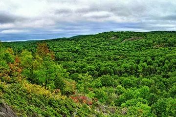
Photo by Aaron Carlson
North Country Trail includes good examples of most of the major community types known from the Penokee/Gogebic Iron Range Landtype. In particular, there are several significant pockets of older sugar maple-basswood forest with a rich, mesic understory. One of these stands had a large component of American elm which died in the late 1970s and was not salvaged, making it a unique site with large amounts of coarse woody debris and standing snags.
This site also contains two high-quality hemlock-hardwood stands, which is relatively uncommon on this land type. Another important ecological feature is a steep-sided ravine containing Hawkin's Creek, a small cold-water trout stream. This ravine includes vertical shaded cliffs, upland hemlock and white cedar, Canada yew and a state-threatened plant. Other unnamed streams run through small bedrock ravines and contain uncommon/rare plants. The Marengo River with its associated cliffs, dry talus, and open bedrock glades runs through the westernmost portion of the site. Of note are the ruins of The Swedish Settlement, a well-known historical site. North Country Trail Hardwoods is owned by the US Forest Service and was designated a State Natural Area in 2007.
Very few State Natural Areas have public facilities, but nearly all are open for a variety of recreational activities as indicated below. Generally, there are no picnic areas, restrooms, or other developments. Parking lots or designated parking areas are noted on individual SNA pages and maps. If a developed trail is present, it will normally be noted on the SNA map and/or under the Maps tab. A compass and topographic map or a GPS unit are useful tools for exploring larger, isolated SNAs.
The good majority of SNAs are isolated and have few or no facilities. Some SNAs have vehicle access lanes or parking lots, but their accessibility may vary depending on weather conditions. Parking lots and lanes are not plowed during winter. Hiking trails may be nonexistent or consist of undeveloped footpaths. A GPS unit or compass and a detailed topographic map are useful tools for exploring larger SNAs.
Non-DNR lands
Entrance fees: For non-DNR-owned SNAs, we are unaware of any vehicle or admission fees. However, please contact the landowner for more information.
Hunting and trapping
Other activities
Other allowable activities such as - but not limited to camping, geocaching and bicycling are determined by the landowner. Please contact them directly or visit their websites for details.
Location
Within the Chequamegon-Nicolet National Forest, Bayfield County. T44N-R5W, Sections 1, 2, 3, 9-12, 15. 371 acres.
Driving directions
From the intersection of US Highway 63 and County D in Grandview, go south on D for 2.1 miles, then east on Camp 8 Road (FR 377) for 4.2 miles, then south on Old Grade Road (FR202) for 1.7 miles. Park and walk east on the North County Trail 0.4 miles into the site.
The DNR's state natural areas program is comprised of lands owned by the state, private conservation organizations, municipalities, other governmental agencies, educational institutions and private individuals. While the majority of SNAs are open to the public, access may vary according to individual ownership policies. Public use restrictions may apply due to public safety, or to protect endangered or threatened species or unique natural features. Lands may be temporarily closed due to specific management activities.
Users are encouraged to contact the landowner for more specific details. The data shown on these maps have been obtained from various sources, and are of varying age, reliability, and resolution. The data may contain errors or omissions and should not be interpreted as a legal representation of legal ownership boundaries. To create your custom map where you can zoom to a specific location, please use the DNR's Mapping Application.
North Country Trail Hardwoods is owned by: US Forest Service