North Bay
No. 381
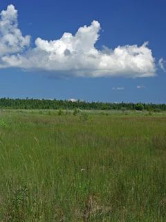
Photo by Thomas A. Meyer/DNR
North Bay features one of the last remaining undeveloped stretches of Lake Michigan shore on the Door Peninsula. With nearly one mile of uninterrupted lakeshore, this site offers a range of plant communities that change through time in response to the periodic rise and fall of lake water levels. The site contains many high-quality remnant communities including northern sedge meadow, calcareous fen, northern wet, wet-mesic and mesic forest, boreal forests of white spruce and balsam fir, and springs and spring runs. Also present are coastal marshes and a complex of Lake Michigan dunes with associated ridge and swale topography.
From the open waters of the lake to the coastal marshes and fen, to the lowland forest and surrounding uplands, this area provides critical habitat for many endangered and threatened species and numerous orchids. North Bay is also an important spawning area for a majority of Lake Michigan’s whitefish population. Of the estimated 1.2-1.5 million whitefish, approximately 1.1 million spawn in the waters between North Bay and Moonlight Bay in Door County. Outlet streams also provide important habitat for numerous game fish species including northern pike, yellow perch, smallmouth bass, trout, and chinook salmon. Six species of rare or uncommon birds use this area for nesting and foraging including the bald eagle and osprey.
This site also provides critical habitat for a wide diversity of migratory and nesting waterfowl including bufflehead, redhead, hooded mergansers, and northern pintail and the area is one of the few known nesting sites in Wisconsin of common goldeneye. A wide variety of shorebirds are also known to use the area. North Bay is owned by The Nature Conservancy and The Door County Land Trust. It was designated a State Natural Area in 2002.
Very few State Natural Areas have public facilities, but nearly all are open for a variety of recreational activities as indicated below. Generally, there are no picnic areas, restrooms, or other developments. Parking lots or designated parking areas are noted on individual SNA pages and maps. If a developed trail is present, it will normally be noted on the SNA map and/or under the Maps tab. A compass and topographic map or a GPS unit are useful tools for exploring larger, isolated SNAs.
The good majority of SNAs are isolated and have few or no facilities. Some SNAs have vehicle access lanes or parking lots, but their accessibility may vary depending on weather conditions. Parking lots and lanes are not plowed during winter. Hiking trails may be nonexistent or consist of undeveloped footpaths. A GPS unit or compass and a detailed topographic map are useful tools for exploring larger SNAs.
Hunting and trapping
This preserve is open to deer hunting by landowner regulations. Visit The Nature Conservancy [exit DNR] and The Door County Land Trust [exit DNR] for more information.
Allowable activities: DNR-owned land
The activities listed below are generally allowed on all DNR-owned SNA lands. Exceptions to this list of public uses, such as SNAs closed to hunting, are noted above and posted with signs on the property site.
- Hiking
- Fishing
- Cross country skiing
- Hunting
- Trapping
- Scientific research (permit required [PDF])
- Outdoor education
- Wild edibles (What is this?)
- Pets (Rules)
- Wildlife viewing
Prohibited activities: all SNAs
- Camping and campfires
- Collecting of animals (other than legally harvested species), non-edible fungi, rocks, minerals, fossils, archaeological artifacts, soil, downed wood, or any other natural material, alive or dead.
- Collecting for scientific research requires a permit issued by the DNR
- Collecting of plants including seeds, roots or other non-edible parts of herbaceous plants such as wildflowers or grasses
- Geocaching
- Horseback riding
- Rock climbing
- Vehicles, including bicycles, ATVs, aircraft, and snowmobiles except on trails and roadways designated for their use.
For rules governing state-owned SNAs and other state lands, please consult Chapter NR 45 Wis. Admin. Code [exit DNR].
Location
Door County. T31N-R28E, Sections 10, 11, 15, 21, 22, 23, 27. 1,259 acres (TNC=835 and DCLT=424).
Driving directions
From the junction of Highways 42 and ZZ (Maple Drive) in Sister Bay, go east on ZZ for 0.6 miles, then south on Wood Crest Road for nearly 2 miles, then east and southeast on County Q for 1.4 miles, then north on Winding Lane for 0.25 mile to a small parking area east of the road.
The DNR's state natural areas program is comprised of lands owned by the state, private conservation organizations, municipalities, other governmental agencies, educational institutions and private individuals. While the majority of SNAs are open to the public, access may vary according to individual ownership policies. Public use restrictions may apply due to public safety, or to protect endangered or threatened species or unique natural features. Lands may be temporarily closed due to specific management activities.
Users are encouraged to contact the landowner for more specific details. The data shown on these maps have been obtained from various sources, and are of varying age, reliability, and resolution. The data may contain errors or omissions and should not be interpreted as a legal representation of legal ownership boundaries. To create your custom map where you can zoom to a specific location, please use the DNR's Mapping Application.
North Bay is owned by: Door County Land Trust and The Nature Conservancy