Nelligan Lake
No. 484
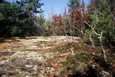
Photo by U.S. Forest Service
Nelligan Lake is characterized by extensive areas of conifer swamp including black spruce swamp, white cedar swamp, black ash swamp, and wet jack pine forest. Embedded within this wetland matrix are igneous outcrop islands covered with northern dry-mesic forest comprised of red oak, aspen, paper birch, and red maple. Pin oak and white oak are also present. In areas of exposed bedrock are acid bedrock glades and shaded and exposed cliffs. The tree dominance changes to white pine, red pine and stunted red oak. Sheer cliff faces of 30 feet are present.
From the highest point in the complex, Butler Rock is visible approximately 3 miles southeast. On sandy low ridges are good quality stands of red and white pine with some trees approaching 24 inches in diameter. Of note is an apparent beach ridge around the north shore of Nelligan Lake that supports red and white pine about 5 feet above the water level and separates the lake from the black spruce-tamarack swamp to the north. A wet jack pine forest borders the swamp. The ground layer is covered with sphagnum, bog sedges, and ericaceous shrubs including leatherleaf, Labrador tea, and bog laurel. At the west end of the complex is clear-water, sandy-bottomed Nelligan Lake, which harbors a fine community of rosette-forming submerged aquatic plants including two species of rare bladderworts. Nelligan Lake is owned by the US Forest Service and was designated a State Natural Area in 2007.
Very few State Natural Areas have public facilities, but nearly all are open for a variety of recreational activities as indicated below. Generally, there are no picnic areas, restrooms, or other developments. Parking lots or designated parking areas are noted on individual SNA pages and maps. If a developed trail is present, it will normally be noted on the SNA map and/or under the Maps tab. A compass and topographic map or a GPS unit are useful tools for exploring larger, isolated SNAs.
The good majority of SNAs are isolated and have few or no facilities. Some SNAs have vehicle access lanes or parking lots, but their accessibility may vary depending on weather conditions. Parking lots and lanes are not plowed during winter. Hiking trails may be nonexistent or consist of undeveloped footpaths. A GPS unit or compass and a detailed topographic map are useful tools for exploring larger SNAs.
Non-DNR lands
Entrance fees: For non-DNR-owned SNAs, we are unaware of any vehicle or admission fees. However, please contact the landowner for more information.
Hunting and trapping
Other activities
Other allowable activities such as - but not limited to camping, geocaching and bicycling are determined by the landowner. Please contact them directly or visit their websites for details.
Location
Within the Chequamegon-Nicolet National Forest. Oconto County. T32N-R17E, Sections 22-27, 36. 1,500 acres.
Driving directions
The site is located about 7 miles northeast of Mountain and 9 miles southeast of Lakewood on the Marinette County border. Access is via FR 2272 in the west, FR 2327 from the north, and FR 2309 from the south.
The DNR's state natural areas program is comprised of lands owned by the state, private conservation organizations, municipalities, other governmental agencies, educational institutions and private individuals. While the majority of SNAs are open to the public, access may vary according to individual ownership policies. Public use restrictions may apply due to public safety, or to protect endangered or threatened species or unique natural features. Lands may be temporarily closed due to specific management activities.
Users are encouraged to contact the landowner for more specific details. The data shown on these maps have been obtained from various sources, and are of varying age, reliability, and resolution. The data may contain errors or omissions and should not be interpreted as a legal representation of legal ownership boundaries. To create your custom map where you can zoom to a specific location, please use the DNR's Mapping Application.
Nelligan Lake is owned by: US Forest Service