Moose River Cedar Hills
No. 438
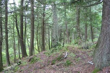
Photo by U.S. Forest Service
Moose River Cedar Hills features patches of upland mesic cedar forest bordering tributaries of the Moose River. These stands are associated with good quality examples of wetland communities including a long-established beaver flowage, northern sedge meadow/alder thicket, black spruce-tamarack bog, and northern hardwood swamp. Patches of upland forest bordering tributaries of the Moose River are dominated by medium-large northern white cedar with super canopy white pine and associated hemlock, yellow birch, paper birch, and red maple.
The shrub and sapling layer is sparse and heavy deer browse is occurring throughout. Common herbaceous species include three-leaved goldthread, wood sorrel, Canada mayflower, intermediate wood fern, common oak fern, northern tree club-moss, rosy twisted stalk, and yellow blue bead lily. On mid and lower slopes is a mature stand of rich, maple-basswood forest grading into mixed hardwood swamp forest west of the stream corridor.
The northern mesic forest is dominated by sugar maple with associated basswood and lesser amounts of white ash, black ash, yellow birch, red maple, hemlock and white cedar. The characteristic ground flora includes lady fern, blue cohosh, wild ginger, wild leek, and downy yellow violet. To the south is an island of seral stage forest dominated by aspen, birch, and balsam fir with upland black spruce, white spruce, and tamarack giving it a `boreal' like character. The ground layer is covered with dense bracken fern. The uncommon gray jay is known to inhabit the area. Other bird species include yellow-throated vireo, winter wren, wood thrush, ovenbird, and blackburnian warbler.
This site occurs in a relatively remote setting and is well-buffered by wetland communities. The requirements and functions of upland mesic cedar forests are unknown and opportunities for research here are not duplicated anywhere else in the forest. Moose River Cedar Hills is owned by the US Forest Service and was designated a State Natural Area in 2007.
Very few State Natural Areas have public facilities, but nearly all are open for a variety of recreational activities as indicated below. Generally, there are no picnic areas, restrooms, or other developments. Parking lots or designated parking areas are noted on individual SNA pages and maps. Trails, if present, are typically undesignated footpaths. If a developed trail is present, it will normally be noted on the SNA map. A compass and topographic map or a GPS unit are useful tools for exploring larger, isolated SNAs.
The good majority of SNAs are isolated and have few or no facilities. Some SNAs have vehicle access lanes or parking lots, but their accessibility may vary depending on weather conditions. Parking lots and lanes are not plowed during winter. Hiking trails may be nonexistent or consist of undeveloped footpaths. A GPS unit or compass and a detailed topographic map are useful tools for exploring larger SNAs.
Non-DNR lands
Entrance fees: For non-DNR-owned SNAs, we are unaware of any vehicle or admission fees. However, please contact the landowner for more information.
Hunting and trapping
Other activities
Other allowable activities such as - but not limited to camping, geocaching and bicycling are determined by the landowner. Please contact them directly or visit their websites for details.
Location
Within the Chequamegon-Nicolet National Forest, Sawyer County. T41N-R5W, Sections 21, 22, 27, 28. 601 acres.
Driving directions
From Clam Lake go southwest on Highway 77 for 7.5 miles, then south on FR 174 for about 5.5 miles, then east on FR 164 0.25 mile to the northern boundary of the site.
The DNR's state natural areas program is comprised of lands owned by the state, private conservation organizations, municipalities, other governmental agencies, educational institutions and private individuals. While the majority of SNAs are open to the public, access may vary according to individual ownership policies. Public use restrictions may apply due to public safety, or to protect endangered or threatened species or unique natural features. Lands may be temporarily closed due to specific management activities.
Users are encouraged to contact the landowner for more specific details. The data shown on these maps have been obtained from various sources, and are of varying age, reliability, and resolution. The data may contain errors or omissions and should not be interpreted as a legal representation of legal ownership boundaries. To create your custom map where you can zoom to a specific location, please use the DNR's Mapping Application.
Moose River Cedar Hills is owned by: US Forest Service