Lost Creek Bog
No. 274
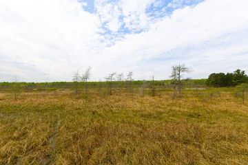
Photo by Josh Mayer
Lost Creek Bog features a Lake Superior estuarine system at the drowned mouths of three small creeks (Lost Creek 1, 2, and 3) where they empty into Siskiwit Bay. A coastal barrier sand spit forested with spruce and pine separates the wetlands from the lake. Shore fen, grading to open sedge bog, shrub swamp, and northern wet forest dominated by tamarack are the major communities in the natural area. The fen is well developed on the west and north sides of the lagoon, with a mat composed of woolly sedge, bogbean, sweet gale, and cotton grass.
Boggy areas are dominated by Sphagnum mosses, sedges, leather-leaf and other ericaceous shrubs. Lost Creek 1 and 2 are flat, shallow, cold water streams with sandy bottoms that sustain a small brook trout population. Lost Creek 3 is a warm water drainage stream supporting minnows. The emergent marsh at their confluence harbors the largest known Wisconsin population of a state-endangered plant. Flora of the marsh is composed of lake sedge, water arum, marsh cinquefoil, and cat-tail.
Bur-reed, water milfoil, yellow water-lily, common bladderwort, and pondweeds are among the submergent and floating-leaved species in the marsh. Several rare plants and animals have been recorded in the natural area. Uncommon nesting birds recorded here include yellow-bellied flycatcher and merlin. Migratory waterfowl and other water birds make extensive use of the site. Lost Creek Bog is owned by the DNR and was designated a State Natural Area in 1993.
Very few State Natural Areas have public facilities, but nearly all are open for a variety of recreational activities as indicated below. Generally, there are no picnic areas, restrooms, or other developments. Parking lots or designated parking areas are noted on individual SNA pages and maps. If a developed trail is present, it will normally be noted on the SNA map and/or under the Maps tab. A compass and topographic map or a GPS unit are useful tools for exploring larger, isolated SNAs.
The good majority of SNAs are isolated and have few or no facilities. Some SNAs have vehicle access lanes or parking lots, but their accessibility may vary depending on weather conditions. Parking lots and lanes are not plowed during winter. Hiking trails may be nonexistent or consist of undeveloped footpaths. A GPS unit or compass and a detailed topographic map are useful tools for exploring larger SNAs.
Entrance fees: Except for Parfrey's Glen, the Cambrian Outlook in the Dells of the Wisconsin River, SNAs within State Parks and some within State Forests, all other DNR-owned SNAs do not have any admission fees. For more information, see Wis. Admin. Code NR 45 [exit DNR]. For non-DNR-owned SNAs, we are unaware of any vehicle or admission fees. However, please contact the landowner for more information.
Allowable activities: DNR-owned land
The activities listed below are generally allowed on all DNR-owned SNA lands. Exceptions to this list of public uses, such as SNAs closed to hunting, are noted above and posted with signs on the property site.
- Hiking
- Fishing
- Cross country skiing
- Hunting
- Trapping
- Scientific research (permit required [PDF])
- Outdoor education
- Wild edibles (What is this?)
- Pets (Rules)
- Wildlife viewing
Prohibited activities: all SNAs
Although a handful of sites allow activities like primitive camping (e.g. Lower Chippewa River on sand bars) or horseback riding (e.g. S. Kettle Moraine), the activities listed below are generally prohibited on DNR-owned SNAs.
- Camping and campfires
- Collecting of animals (other than legally harvested species), non-edible fungi, rocks, minerals, fossils, archaeological artifacts, soil, downed wood, or any other natural material, alive or dead.
- Collecting for scientific research requires a permit issued by the DNR
- Collecting of plants including seeds, roots or other non-edible parts of herbaceous plants such as wildflowers or grasses
- Drones: Flying-related activities, including the use of drones, hang-gliders and model airplanes, are prohibited. Permission may be issued by the SNA Program for the use of drones for educational or research purposes
- Geocaching
- Horseback riding
- Rock climbing
- Vehicles, including bicycles, ATVs, aircraft, and snowmobiles except on trails and roadways designated for their use.
For rules governing state-owned SNAs and other state lands, please consult Chapter NR 45 Wis. Admin. Code [exit DNR].
Location
Bayfield County. T50N-R6W, Sections 4, 5. T51N-R6W, Sections 32, 33, 34. 853 acres.
Driving directions
At the junction of State Highway 13 and County Highway C in Cornucopia, go west on Blueberry Lane about 1.3 miles to its end. Park at the undeveloped canoe/kayak launch for access to the northern portion of the bog via foot or water.
The remainder of the wetland is best accessed by canoe/kayak. Uplands are accessible adjacent to Highway 13 on the south or Roman Point Road on the west.
The DNR's state natural areas program is comprised of lands owned by the state, private conservation organizations, municipalities, other governmental agencies, educational institutions and private individuals. While the majority of SNAs are open to the public, access may vary according to individual ownership policies. Public use restrictions may apply due to public safety, or to protect endangered or threatened species or unique natural features. Lands may be temporarily closed due to specific management activities.
Users are encouraged to contact the landowner for more specific details. The data shown on these maps have been obtained from various sources, and are of varying age, reliability, and resolution. The data may contain errors or omissions and should not be interpreted as a legal representation of legal ownership boundaries. To create your custom map where you can zoom to a specific location, please use the DNR's Mapping Application.
Lost Creek Bog is owned by: Wisconsin DNR