Lake Owen Hardwoods
No. 425
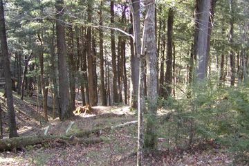
Photo by U.S. Forest Service
Located along the north side of Lake Owen is a mile-wide peninsula that supports several high-quality stands of old-growth hemlock-hardwoods in a large tract of unfragmented, maturing mesic and dry-mesic forest near the Lake Owen shore. Hemlock is reproducing under the fire-origin paper birch. The good quality is mesic to dry-mesic hardwoods dominated by sugar maple and red oak (18-24 inches) with scattered white pine and smaller amounts of paper birch, big-toothed aspen, and red maple. Common ground layer species include sweet cicely, big-leaved aster, Pennsylvania sedge, Canada mayflower, sessile-leaved bellwort, downy Solomon's-seal, and shining club moss. Several small seepage lakes and ponds also occur within the site.
These are associated with communities of black ash swamp, muskeg/open bog, emergent and floating leaved aquatics, and red maple-cinnamon fern swamp with iris swales. Mature, rich sugar maple-basswood forest is scattered throughout. Also present is a small inclusion of bedrock-controlled landscape (Gogebic-Penokee Range) with shaded wet and dry cliffs that support a remnant red pine community and two rare plant species. Moose have been seen in this part of Wisconsin in past years. The site represents one of the longest stretches of Federal land ownership on Lake Owen and maintains its wild character. With its rich mosaic of varied landscapes, mature forest types, old-growth fragments, remoteness and little evidence of recent disturbance, Lake Owen is one of the better examples of a large block of relatively undisturbed northern forests on the Chequamegon-Nicolet. Lake Owen is owned by the US Forest Service and was designated a State Natural Area in 2007.
Very few State Natural Areas have public facilities, but nearly all are open for a variety of recreational activities as indicated below. Generally, there are no picnic areas, restrooms, or other developments. Parking lots or designated parking areas are noted on individual SNA pages and maps. If a developed trail is present, it will normally be noted on the SNA map and/or under the Maps tab. A compass and topographic map or a GPS unit are useful tools for exploring larger, isolated SNAs.
The good majority of SNAs are isolated and have few or no facilities. Some SNAs have vehicle access lanes or parking lots, but their accessibility may vary depending on weather conditions. Parking lots and lanes are not plowed during winter. Hiking trails may be nonexistent or consist of undeveloped footpaths. A GPS unit or compass and a detailed topographic map are useful tools for exploring larger SNAs.
Non-DNR lands
Entrance fees: For non-DNR-owned SNAs, we are unaware of any vehicle or admission fees. However, please contact the landowner for more information.
Hunting and trapping
Other activities
Other allowable activities such as - but not limited to camping, geocaching and bicycling are determined by the landowner. Please contact them directly or visit their websites for details.
Location
Within the Chequamegon-Nicolet National Forest, Bayfield County. T44N-R7W, Sections 1, 2, 11, 12, 13. T45N-R7W, Section 36. 1,535 acres.
Driving directions
The site is 3 miles southeast of Drummond on Forest Road 213. Parts of the site are accessible via Forest Roads 214, 217, and 371.
The DNR's state natural areas program is comprised of lands owned by the state, private conservation organizations, municipalities, other governmental agencies, educational institutions and private individuals. While the majority of SNAs are open to the public, access may vary according to individual ownership policies. Public use restrictions may apply due to public safety, or to protect endangered or threatened species or unique natural features. Lands may be temporarily closed due to specific management activities.
Users are encouraged to contact the landowner for more specific details. The data shown on these maps have been obtained from various sources, and are of varying age, reliability, and resolution. The data may contain errors or omissions and should not be interpreted as a legal representation of legal ownership boundaries. To create your custom map where you can zoom to a specific location, please use the DNR's Mapping Application.
Lake Owen Hardwoods is owned by: US Forest Service