Kidrick Swamp
No. 464
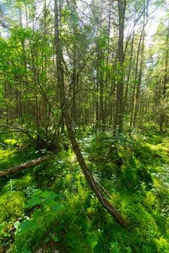
Photo by Josh Mayer
Kidrick Swamp is a large, hydrologically intact peatland complex of black spruce and tamarack bog and black spruce muskeg situated within a matrix of extensive upland hardwood forest. Numerous ericaceous understory shrubs are present including velvet-leaf blueberry, small cranberry, Labrador-tea, leather-leaf, creeping snowberry, and bog-laurel. Sedges include few-seeded (Carex oligosperma), boreal bog (C. magellanica), few-flowered (C. pauciflora), and three-seeded (C. trisperma).
Tawny cotton grass, tussock cotton grass, and moccasin flower are also present. "Moated" areas along the swamp edges have cinnamon fern, false mayflower, and crested shield fern. On the nearly level, somewhat poorly drained ground moraine and surrounding upland islands are rich mesic hardwoods dominated by sugar maple, basswood, white ash, black ash, and red oak. A sparse, poorly developed shrubs layer is occupied primarily by alternate-leaved dogwood. White ash and maple seedlings are moderately dense.
The stand is even-aged but large-diameter white ash, black ash, and red oak are present in some numbers. The ground flora contains most of the rich site indicator species including wood anemone, dwarf ginseng, wild leek, bishop's cap, wild geranium, blue cohosh, and bloodroot. Many neotropical migratory birds breed here including the yellow-bellied flycatcher and golden-winged warbler. Other species include wood duck, alder flycatcher, sedge wren, veery, hermit thrush, mourning warbler, Nashville warbler, ovenbird, rose-breasted grosbeak, and white-throated sparrow. Kidrick Swamp is owned by the US Forest Service and was designated a State Natural Area in 2007.
Very few State Natural Areas have public facilities, but nearly all are open for a variety of recreational activities as indicated below. Generally, there are no picnic areas, restrooms, or other developments. Parking lots or designated parking areas are noted on individual SNA pages and maps. If a developed trail is present, it will normally be noted on the SNA map and/or under the Maps tab. A compass and topographic map or a GPS unit are useful tools for exploring larger, isolated SNAs.
The good majority of SNAs are isolated and have few or no facilities. Some SNAs have vehicle access lanes or parking lots, but their accessibility may vary depending on weather conditions. Parking lots and lanes are not plowed during winter. Hiking trails may be nonexistent or consist of undeveloped footpaths. A GPS unit or compass and a detailed topographic map are useful tools for exploring larger SNAs.
Non-DNR lands
Entrance fees: For non-DNR-owned SNAs, we are unaware of any vehicle or admission fees. However, please contact the landowner for more information.
Hunting and trapping
Other activities
Other allowable activities such as - but not limited to camping, geocaching and bicycling are determined by the landowner. Please contact them directly or visit their websites for details.
Location
Within the Chequamegon-Nicolet National Forest. Taylor County. T33N-R2W, Sections 19, 20, 21, 26, 27, 28, 31, 32.
Driving directions
The site can be accessed from Jump River. From the intersection of Highways 73 and D just east of Jump River, go east on D for 6.3 miles, then south on FR 113 for 2.3 miles. The swamp lies east of the road.
The DNR's state natural areas program is comprised of lands owned by the state, private conservation organizations, municipalities, other governmental agencies, educational institutions and private individuals. While the majority of SNAs are open to the public, access may vary according to individual ownership policies. Public use restrictions may apply due to public safety, or to protect endangered or threatened species or unique natural features. Lands may be temporarily closed due to specific management activities.
Users are encouraged to contact the landowner for more specific details. The data shown on these maps have been obtained from various sources, and are of varying age, reliability, and resolution. The data may contain errors or omissions and should not be interpreted as a legal representation of legal ownership boundaries. To create your custom map where you can zoom to a specific location, please use the DNR's Mapping Application.
Kidrick Swamp is owned by: US Forest Service