Kelly Lake Hemlocks
No. 560
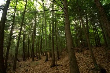
Photo by Josh Mayer
Kelly Lake Hemlocks contains an extensive northern mesic forest situated on rolling glacial deposits north and west of Long Lake. Medium-sized sugar maple, beech, red oak, and paper birch comprise the forest although scattered patches of older hemlock, beech, and yellow birch are also present. Both hemlock and beech are reproducing well. The ground flora is well represented with spotted coral root, wintergreen, big-leaved aster, rattlesnake plantain, and partridgeberry. Several patches of the uncommon Indian cucumber root also occur here.
Several small conifer swamps are found within the mesic forest matrix. Tree species include tamarack, black spruce, white cedar, balsam fir, hemlock, and white pine. An undisturbed kettle bog complex is found in the northeast corner of the site and supports species such as blue joint grass, tussock sedge, and leatherleaf. Long Lake is a 38-acre seepage lake with a maximum depth of 22 feet. Along the undeveloped north and west shoreline is a forest of mature white pine with sugar maple and beech. Birds using the lake area include bald eagle, great blue heron, belted kingfisher, ring-necked duck, hooded merganser, and wood duck.
To the northeast the soils become sandier and there is a transition from mesic to a dry-mesic forest dominated by white pine with paper birch, red oak, and big-tooth aspen. Forest birds include pileated woodpecker, hairy woodpecker, red-breasted nuthatch, white-breasted nuthatch, hermit thrush, raven, and golden-crowned kinglet. Kelly Lake Hemlocks is privately owned. A conservation easement was donated to the Department and the site was designated a State Natural Area in 2008.
Very few State Natural Areas have public facilities, but nearly all are open for a variety of recreational activities as indicated below. Generally, there are no picnic areas, restrooms, or other developments. Parking lots or designated parking areas are noted on individual SNA pages and maps. If a developed trail is present, it will normally be noted on the SNA map and/or under the Maps tab. A compass and topographic map or a GPS unit are useful tools for exploring larger, isolated SNAs.
The good majority of SNAs are isolated and have few or no facilities. Some SNAs have vehicle access lanes or parking lots, but their accessibility may vary depending on weather conditions. Parking lots and lanes are not plowed during winter. Hiking trails may be nonexistent or consist of undeveloped footpaths. A GPS unit or compass and a detailed topographic map are useful tools for exploring larger SNAs.
Non-DNR lands
Entrance fees: For non-DNR-owned SNAs, we are unaware of any vehicle or admission fees. However, please contact the landowner for more information.
Hunting and trapping
Other activities
Other allowable activities such as - but not limited to camping, geocaching and bicycling are determined by the landowner. Please contact them directly or visit their websites for details.
Location
Oconto County. T30N-R19E, Section 31. 210 acres.
Driving directions
Except for lands open under the Managed Forest Law (MFL), this site is closed to the public. See the map for details.
The DNR's state natural areas program comprises lands owned by the state, private conservation organizations, municipalities, other governmental agencies, educational institutions and private individuals. While the majority of SNAs are open to the public, access may vary according to individual ownership policies. Public use restrictions may apply due to public safety, or to protect endangered or threatened species or unique natural features. Lands may be temporarily closed due to specific management activities.
Users are encouraged to contact the landowner for more specific details. The data shown on these maps have been obtained from various sources, and are of varying age, reliability, and resolution. The data may contain errors or omissions and should not be interpreted as a legal representation of legal ownership boundaries. To create your custom map where you can zoom to a specific location, please use the DNR's Mapping Application.
Kelly Lake Hemlocks is owned by: Private