Hog Island Tamaracks
No. 579
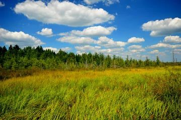
Photo by Josh Mayer
Situated within the flat, sandy bed of Glacial Lake Wisconsin, Hog Island Tamaracks features a northern wet forest of tamarack and black spruce. Low sandy ridges are interspersed within the flat plain. The shrub layer is dominated by huckleberry with winterberry and mountain holly. The herb and low shrub layer is typical of this community type and includes Canada bunchberry, swamp dewberry, cinnamon fern, and tawny cotton grass. This peatland community provides habitat for numerous Species of Greatest Conservation Need found at their southern range limit including Canada warbler, Connecticut warbler, and veery. In addition several bird species with northern affinities such as hermit thrush, white-throated sparrow, yellow-rumped warbler, and Nashville warbler nest within this coniferous forest. Hog Island Tamaracks is owned by Wood County and the U.S. Government. It was established as a State Natural Area in 2008.
Very few State Natural Areas have public facilities, but nearly all are open for a variety of recreational activities as indicated below. Generally, there are no picnic areas, restrooms, or other developments. Parking lots or designated parking areas are noted on individual SNA pages and maps. If a developed trail is present, it will normally be noted on the SNA map and/or under the Maps tab. A compass, topographic map, or GPS unit are useful tools for exploring larger, isolated SNAs.
The good majority of SNAs are isolated and have few or no facilities. Some SNAs have vehicle access lanes or parking lots, but their accessibility may vary depending on weather conditions. Parking lots and lanes are not plowed during winter. Hiking trails may be nonexistent or consist of undeveloped footpaths. A GPS unit or compass and a detailed topographic map are valuable tools for exploring larger SNAs.
Non-DNR lands
Entrance fees: For non-DNR-owned SNAs, we are unaware of any vehicle or admission fees. However, please contact the landowner for more information.
Hunting and trapping
Other activities
Other allowable activities such as - but not limited to camping, geocaching and bicycling are determined by the landowner. Please contact them directly or visit their websites for details.
Location
Three units within the Wood County Wildlife Area and Wood County Forest. T21N-R2E, Sections 7, 18, 31. T20N-R2E, Section 5. 462 acres.
Driving directions
From the intersection of Highways 80 (North) and 173 in Babcock, go south on 173 for 1.1 miles, then west on County X for 0.7 miles, and continue west on Ball Road for 8.8 miles. The site lies north and south of the road. Or continue west another 0.7 miles, then south on Cranberry Road for 3.8 miles. The site lies east of the road. To access the 3rd unit, from the intersection of Highways 80 (South) and 173 just south of Babcock, go south on 173 for 7.2 miles, then west on 3rd Street W for 3 miles, then north along a ditch 0.9 miles. Walk west nearly 0.2 miles to the tamaracks.
The DNR's state natural areas program is comprised of lands owned by the state, private conservation organizations, municipalities, other governmental agencies, educational institutions and private individuals. While the majority of SNAs are open to the public, access may vary according to individual ownership policies. Public use restrictions may apply due to public safety, or to protect endangered or threatened species or unique natural features. Lands may be temporarily closed due to specific management activities.
Users are encouraged to contact the landowner for more specific details. The data shown on these maps have been obtained from various sources, and are of varying age, reliability, and resolution. The data may contain errors or omissions and should not be interpreted as a legal representation of legal ownership boundaries. To create your custom map where you can zoom to a specific location, please use the DNR's Mapping Application.
Hog Island Tamaracks is owned by: The U.S. Government and Wood County