Hedmark Pines
No. 453
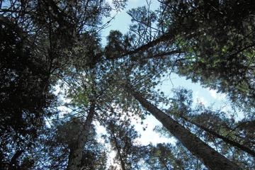
Photo by U.S. Forest Service
The highlight of Hedmark Pines is the natural origin pine occurring along the Popple River with most late-successional stands containing a canopy of pure red pine. Super-canopy pines are found within the younger forests. The ground layer has abundant pine needles and relatively sparse vegetation of bracken fern, Canada mayflower, twinflower, early low blueberry, partridge berry, and cow wheat. Three included small watersheds along the Popple River contain examples of northern sedge meadow, alder thicket, shrub-carr, and open bog communities. A rare plant is found within the complex. Also present is a quality jack pine stand, which contains an interesting ground layer with Cladonia, nodding lady's tresses, and pale panic grass. The complex also contains approximately three miles of the Popple River. Riparian areas along the river include both open northern sedge meadows and narrow floodplain forests with occasional silver maple and green ash. All streams within the complex include both submerged and emergent aquatic communities. Hedmark Pines is owned by the US Forest Service and was designated a State Natural Area in 2007.
Very few State Natural Areas have public facilities, but nearly all are open for a variety of recreational activities as indicated below. Generally, there are no picnic areas, restrooms, or other developments. Parking lots or designated parking areas are noted on individual SNA pages and maps. If a developed trail is present, it will usually be noted on the SNA map and/or under the Maps tab. A compass and topographic map or a GPS unit are useful tools for exploring larger, isolated SNAs.
The good majority of SNAs are isolated and have few or no facilities. Some SNAs have vehicle access lanes or parking lots, but their accessibility may vary depending on weather conditions. Parking lots and lanes are not plowed during winter. Hiking trails may be nonexistent or consist of undeveloped footpaths. A GPS unit or compass and a detailed topographic map are useful tools for exploring larger SNAs.
Non-DNR lands
Entrance fees: For non-DNR-owned SNAs, we are unaware of any vehicle or admission fees. However, please contact the landowner for more information.
Hunting and trapping
Other activities
Other allowable activities such as - but not limited to camping, geocaching and bicycling are determined by the landowner. Please contact them directly or visit their websites for details.
Location
Within the Chequamegon-Nicolet National Forest. Florence County. T38N-R15E, Sections 13, 14, 15, 22, 23, 24; T38N-R16E, Sections 18, 19. 805 acres.
Driving directions
This site occurs approximately 7 miles east and 2 miles north of Newald, Wisconsin. The complex includes about 2 to 3 miles of the Popple River. The site is accessible from Highway 139 and Forest Roads 2159B, 2217, 2398, and 2834.
The DNR's state natural areas program is comprised of lands owned by the state, private conservation organizations, municipalities, other governmental agencies, educational institutions, and private individuals. While the majority of SNAs are open to the public, access may vary according to individual ownership policies. Public use restrictions may apply due to public safety, or to protect endangered or threatened species or unique natural features. Lands may be temporarily closed due to specific management activities.
Users are encouraged to contact the landowner for more specific details. The data shown on these maps have been obtained from various sources, and are of varying age, reliability, and resolution. The data may contain errors or omissions and should not be interpreted as a legal representation of legal ownership boundaries. To create your custom map where you can zoom to a specific location, please use the DNR's Mapping Application.
Hedmark Pines is owned by: U.S. Forest Service