Doering Woods
No. 481
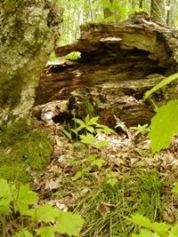
Photo by L. Parker
Doering Woods is a mature stand of hemlock-hardwoods that has a history of selective cutting throughout. Canopy dominants are hemlock and yellow birch. Canopy associates include red maple, sugar maple, paper birch, and white pine with occasional white spruce, balsam fir, and basswood. The largest trees are white pine, several of which have girths over 30 inches in diameter (dbh). Red maple and sugar maple are reproducing successfully, but very little hemlock reproduction is occurring. Deer are undoubtedly hurting hemlock and yellow birch regeneration both of which are favored by deer and intolerant of heavy browsing. Characteristic shrubs are mountain maple, beaked hazelnut, American fly honeysuckle, and red-berried elder.
The ground layer includes species such as intermediate wood fern, Canada mayflower, mountain wood sorrel, three-leaved goldthread, and small enchanter's nightshade. Club mosses are common throughout the tract. Other noteworthy species include slender lady's-tresses, creeping rattlesnake plantain, and spotted coral root. Several spring runs occur within the site. Associated with these are pockets of wet forest in which the dominant trees are white cedar, black ash, and red maple. A 10-acre conifer swamp composed of black spruce and tamarack is also present south of the South Fork of the Flambeau River, which drains the nearby Pike Lake chain and flows southwesterly to eventually join the main channel of the Flambeau River. The river supports many species of game fish including walleye, muskellunge, and northern pike. In addition, uncommon to rare lake sturgeon are found throughout the stream. Doering Woods is owned by the US Forest Service and was designated a State Natural Area in 2007.
Very few State Natural Areas have public facilities, but nearly all are open for a variety of recreational activities as indicated below. Generally, there are no picnic areas, restrooms, or other developments. Parking lots or designated parking areas are noted on individual SNA pages and maps. If a developed trail is present, it will usually be noted on the SNA map and/or under the Maps tab. A compass and topographic map or a GPS unit are useful tools for exploring larger, isolated SNAs.
The good majority of SNAs are isolated and have few or no facilities. Some SNAs have vehicle access lanes or parking lots, but their accessibility may vary depending on weather conditions. Parking lots and lanes are not plowed during winter. Hiking trails may be nonexistent or consist of undeveloped footpaths. A GPS unit or compass and a detailed topographic map are useful tools for exploring larger SNAs.
Non-DNR lands
Entrance fees: For non-DNR-owned SNAs, we are unaware of any vehicle or admission fees. However, please contact the landowner for more information.
Hunting and trapping
Other activities
Other allowable activities such as - but not limited to camping, geocaching and bicycling are determined by the landowner. Please contact them directly or visit their websites for details.
Location
Within the Chequamegon-Nicolet National Forest. Price County. T40N-R3E, Sections 21, 22, 27, 28. 284 acres.
Driving directions
From the intersection of Highways 70 and 13 in Fifield, go east on 70 for about 17 miles, then north on FR 144 for 2.3 miles, then east and north on Logging Dam Road to a parking area. Follow the hiking trail to the old logging dam and cross the river to obtain access to the north part of the Doering Tract. The south part may be reached by following a trail on the south side of the river west.
The DNR's state natural areas program is comprised of lands owned by the state, private conservation organizations, municipalities, other governmental agencies, educational institutions and private individuals. While the majority of SNAs are open to the public, access may vary according to individual ownership policies. Public use restrictions may apply due to public safety, or to protect endangered or threatened species or unique natural features. Lands may be temporarily closed due to specific management activities.
Users are encouraged to contact the landowner for more specific details. The data shown on these maps have been obtained from various sources, and are of varying age, reliability, and resolution. The data may contain errors or omissions and should not be interpreted as a legal representation of legal ownership boundaries. To create your custom map where you can zoom to a specific location, please use the DNR's Mapping Application.
Doering Woods is owned by: U.S. Forest Service