Brule River Cliffs
No. 303
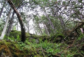
Photo by U.S. Forest Service
Located on the south shore of the Brule River, Brule River Cliffs contains a series of shaded, north-facing cliffs and talus slopes -- a dolomitic outcropping of the Saunders Formation -- with mosses, liverworts, and ferns as prominent members of the cliff flora. The 10-meter-high cliffs and associated ravines are cold, wet, and shaded which is prime habitat for two rare fern species. The cliffs also support many other ferns such as walking, bulblet, oak, common polypody, and long beech fern.
A rich northern mesic forest covers the slopes above and below the cliffs containing both deciduous and coniferous trees. Dominant species include sugar maple, yellow birch, paper birch, white cedar, and aspen. Dense shrub thickets occur at the outcrop base with mountain maple especially prevalent.
Characteristic understory plants include wild sarsaparilla, big-leaved aster, yellow-blue bead-lilies, and blue cohosh. Birds include winter wren, eastern phoebe, rough-winged swallow, eastern pewee, and ovenbird. Brule River Cliffs are owned by the USDA Forest Service and were designated a State Natural Area in 1996.
Very few State Natural Areas have public facilities, but nearly all are open for a variety of recreational activities as indicated below. Generally, there are no picnic areas, restrooms, or other developments. Parking lots or designated parking areas are noted on individual SNA pages and maps. Trails, if present, are typically undesignated footpaths. If a developed trail is present, it will normally be noted on the SNA map located under the Map tab. A compass and topographic map or a GPS unit are useful tools for exploring larger, isolated SNAs.
The good majority of SNAs are isolated and have few or no facilities. Some SNAs have vehicle access lanes or parking lots, but their accessibility may vary depending on weather conditions. Parking lots and lanes are not plowed during winter. Hiking trails may be nonexistent or consist of undeveloped footpaths. A GPS unit or compass and a detailed topographic map are useful tools for exploring larger SNAs.
Non-DNR lands
Entrance fees: For non-DNR-owned SNAs, we are unaware of any vehicle or admission fees. However, please contact the landowner for more information.
Hunting and trapping
Other activities
Other allowable activities such as - but not limited to camping, geocaching and bicycling are determined by the landowner. Please contact them directly or visit their websites for details.
Location
Within Chequamegon-Nicolet National Forest, Florence County. T41N-R16E, Sections 19, 20, 29, 30. 318 acres.
Driving directions
From the intersection of Dream Lake Road and State Highway 70 in Tipler, go east on 70 for 3.5 miles, then north on FR 2152 (Daumitz Road) about 7 miles to the south bank of the Brule River. Walk east about 0.75 miles across abandoned farm fields to the west end of the cliffs.
The DNR's state natural areas program is comprised of lands owned by the state, private conservation organizations, municipalities, other governmental agencies, educational institutions, and private individuals. While the majority of SNAs are open to the public, access may vary according to individual ownership policies. Public use restrictions may apply due to public safety, or to protect endangered or threatened species or unique natural features. Lands may be temporarily closed due to specific management activities.
Users are encouraged to contact the landowner for more specific details. The data shown on these maps have been obtained from various sources, and are of varying age, reliability, and resolution. The data may contain errors or omissions and should not be interpreted as a legal representation of legal ownership boundaries. To create your custom map where you can zoom to a specific location, please use the DNR's Mapping Application.
Brule River Cliffs is owned by: US Forest Service