Blackjack Springs
No. 308
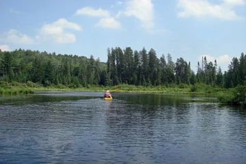
Photo by Graymond
Blackjack Springs is located on pitted sandy outwash south of the Deerskin River and drumlinized ground moraine to the southeast that supports extensive stands of mature, mostly dry-mesic forest on rolling topography. The diverse canopy is composed of red oak, sugar maple, red maple, big-tooth aspen, trembling aspen, paper birch, yellow birch, white pine, hemlock, and balsam fir. Uncommon components of the canopy include red pine and white spruce. Among the trees, sugar maple exhibits the best reproduction and is well represented in both the seedling and sapling class.
White pine is reproducing well in some areas. Relatively dense stands of pole-sized timber, especially on the hogback ridge near the north end, are interspersed with well-structured, uneven-age stands of mature timber. Some of the larger pines exceed 30 inches in diameter adding a super canopy stratum to the forest. The understory varies from open park-like expanses in which ground-hugging herbs predominate to dense thickets of shrubs and saplings. Common understory species include ironwood, beaked hazelnut, American fly honeysuckle, red-berried elder, and raspberries.
Pennsylvania sedge, big-leaved aster, and wild sarsaparilla dominate the herbaceous layer under deciduous trees and in areas where pine is a significant canopy component characteristic species are barren strawberries, wintergreen, and blueberries. Canada mayflower, wood sorrel, bunchberry, three-leaved gold-thread, and American starflower are more common in rich mesic areas. Blackjack Creek is part of the Deerskin River drainage and flows northeast from its source for 5 miles where it then empties into the Deerskin River. The water is clear, slightly alkaline, and of high fertility. Small inclusions of boreal-like white spruce-balsam fir are present in lowland transitional habitats along Blackjack Creek.
The complex also contains several boggy kettle wetlands, groundwater-influenced conifer swamps, headwater streams, and several softwater spring ponds. Bird life is diverse and includes ruby-throated hummingbird, yellow-bellied sapsucker, hermit thrust, golden-crowned kinglet, northern parula, blackburnian warbler, pine warbler, ovenbird, scarlet tanager, and purple finch. Unique and uncommon birds include osprey, gray jay, black-backed woodpecker, veery, black-throated blue warbler, and Nashville warbler. Blackjack Springs was originally designated the Pine-Oak Grove State Natural Area in 1996 and later expanded in 2007.
Very few State Natural Areas have public facilities, but nearly all are open for a variety of recreational activities as indicated below. Generally, there are no picnic areas, restrooms, or other developments. Parking lots or designated parking areas are noted on individual SNA pages and maps. Trails, if present, are typically undesignated footpaths.If a developed trail is present, it will normally be noted on the SNA map located under the "Map" tab. A compass and topographic map or a GPS unit are useful tools for exploring larger, isolated SNAs.
The good majority of SNAs are isolated and have few or no facilities. Some SNAs have vehicle access lanes or parking lots, but their accessibility may vary depending on weather conditions. Parking lots and lanes are not plowed during winter. Hiking trails may be nonexistent or consist of undeveloped footpaths. A GPS unit or compass and a detailed topographic map are useful tools for exploring larger SNAs.
Non-DNR lands
Entrance fees: For non-DNR-owned SNAs, we are unaware of any vehicle or admission fees. However, please contact the landowner for more information.
Hunting and trapping
Other activities
Other allowable activities such as - but not limited to camping, geocaching and bicycling are determined by the landowner. Please contact them directly or visit their websites for details.
Location
Within Chequamegon-Nicolet National Forest, Vilas County. T40N-R11E, Section 1, 2, 3, 10, 11. T41N-R11E, Sections 35, 36. 1,398 acres.
Driving directions
From the intersection of U.S. Highway 45 and State Highway 70 in Eagle River, go east on Highway 70 for 7.6 miles, then north on Military Road for 2.9 miles, then northwest on FR 2178 (Anvil Lake Road) for 1.6 miles to an old logging road and a gate on the west side of the road. Walk west on the logging road 0.5-mile to the site.
The DNR's state natural areas program is comprised of lands owned by the state, private conservation organizations, municipalities, other governmental agencies, educational institutions, and private individuals. While the majority of SNAs are open to the public, access may vary according to individual ownership policies. Public use restrictions may apply due to public safety, or to protect endangered or threatened species or unique natural features. Lands may be temporarily closed due to specific management activities.
Users are encouraged to contact the landowner for more specific details. The data shown on these maps have been obtained from various sources, and are of varying age, reliability, and resolution. The data may contain errors or omissions and should not be interpreted as a legal representation of legal ownership boundaries. To create your custom map where you can zoom to a specific location, please use the DNR's Mapping Application.
Blackjack Springs is owned by: The US Forest Service