Bear Lake Slough
No. 428
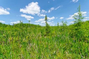
Photo by Josh Mayer
Bear Lake Slough is a complex of natural features and contains a large tract of mature, mesic hardwood forest with significant old-growth hemlock inclusions in a remote setting. Wet-mesic forests of hemlock and cedar are also present and most common. Super-canopy white pines occur in both forest types. Bear Lake, a widespread drainage lake on the East Fork of the Chippewa River, forms the southern boundary of the site. The shoreline is predominantly sand with some gravel and minor areas of rock and muck.
Wetlands and aquatic features associated with this shallow-water lake are significant. Bear Lake slough, an old river channel, still flows during periods of high water. A large island between the slough and the lake's northern shore is forested with a second-growth stand of red and white pine forest on outwash and alluvial deposits. Also present is a variable boreal forest dominated by balsam fir and paper birch. The understory contains an unusual density and diversity of club mosses. Excellent shrub-carr and large sedge meadows maintained by fluctuating water levels occur along the wetland margins of the upland islands and along the river channel to the northeast.
Emergent aquatics in shallow water areas and large beds of wild rice are present at both the inlet and outlet areas. Waterfowl use is heavy during spring and fall migrations. Other aquatic features include Hungry Run, a warm-water drainage stream flowing into the East Fork upstream from Bear Lake. The East Fork Chippewa River is a major drainage stream flowing from Iron County and zigzagging diagonally across the southern portion of Ashland County. Notable species include nesting bald eagles, common loons, spruce grouse, black ducks, and river otters. Fisheries in this segment of the East Fork include a reported lake sturgeon population. Bear Lake Slough is owned by the US Forest Service and was designated a State Natural Area in 2007.
Very few State Natural Areas have public facilities, but nearly all are open for a variety of recreational activities as indicated below. Generally, there are no picnic areas, restrooms, or other developments. Parking lots or designated parking areas are noted on individual SNA pages and maps. Trails, if present, are typically undesignated footpaths. If a developed trail is present, it will normally be noted on the SNA map and/or under the "Access" tab. A compass and topographic map or a GPS unit are useful tools for exploring larger, isolated SNAs.
The good majority of SNAs are isolated and have few or no facilities. Some SNAs have vehicle access lanes or parking lots, but their accessibility may vary depending on weather conditions. Parking lots and lanes are not plowed during winter. Hiking trails may be nonexistent or consist of undeveloped footpaths. A GPS unit or compass and a detailed topographic map are useful tools for exploring larger SNAs.
Non-DNR lands
Entrance fees: For non-DNR-owned SNAs, we are unaware of any vehicle or admission fees. However, please contact the landowner for more information.
Hunting and trapping
Other activities
Other allowable activities such as - but not limited to camping, geocaching and bicycling are determined by the landowner. Please contact them directly or visit their websites for details.
Location
Within the Chequamegon-Nicolet National Forest, Ashland County. T41N-R3W, Sections 30, 31. T41N-R4W, Sections 25, 26. 2,277 acres.
Driving directions
The site is best seen by boat. From the intersection of County GG and FS 163, go east on 163 for approximately 4 miles, then north on FR 169 for one mile to a dirt road on the west side of the road. Follow the dirt road about 0.25 miles to the canoe landing. Canoe downstream to the site.
The DNR's state natural areas program is comprised of lands owned by the state, private conservation organizations, municipalities, other governmental agencies, educational institutions, and private individuals. While the majority of SNAs are open to the public, access may vary according to individual ownership policies. Public use restrictions may apply due to public safety, or to protect endangered or threatened species or unique natural features. Lands may be temporarily closed due to specific management activities.
Users are encouraged to contact the landowner for more specific details. The data shown on these maps have been obtained from various sources, and are of varying age, reliability, and resolution. The data may contain errors or omissions and should not be interpreted as a legal representation of legal ownership boundaries. To create your custom map where you can zoom to a specific location, please use the DNR's Mapping Application.
Bear Lake Slough is owned by: The US Forest Service