Anvil Lake Trail
No. 449
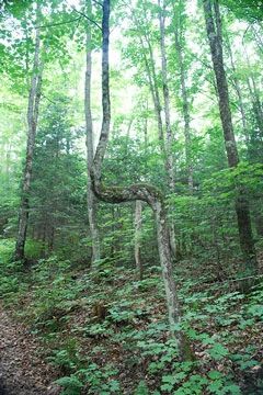
Photo by Joshua Mayer
Anvil Lake Trail features a large, mature contiguous block of northern hardwood forest with inclusions of hemlock and scattered mature hemlock nearly throughout. Other natural communities are northern wet forests and soft-water springs. Hemlock regeneration is significant. On nearly level topography to hummocky with steep slopes, a large majority of the forest is dominated by sugar maple with sizable stands dominated by white pine, hemlock, red oak or older aspen. The pines date from 1888 and some hemlock is older. The best stands have many large hardwoods and hemlock in the 22-28 inch diameter range. Super-canopy white pine is also present throughout much of the site. Yellow birch and basswood are also common. The understory varies from open and park-like to dense hazelnut thickets.
Several large snags and tip-ups are common and coarse woody debris is occasional. The ground layer supports Canada mayflower, intermediate wood fern, lycopods and rough-leaved rice-cut grass. Birds include veery, pine siskin, evening grosbeak, ruby-crowned kinglet, Nashville warbler, black-throated blue warbler and yellow-bellied flycatcher.
Numerous trees of all types and sizes classes, large snags and the open character of the understory contribute to the developing old-growth structure of this site. Anvil Lake Trail is owned by the US Forest Service and was designated a State Natural Area in 2007.
Very few State Natural Areas have public facilities, but nearly all are open for a variety of recreational activities as indicated below. Generally, there are no picnic areas, restrooms, or other developments. Parking lots or designated parking areas are noted on individual SNA pages and maps. Trails, if present, are typically undesignated footpaths. If a developed trail is present, it will normally be noted on the SNA map. A compass and topographic map or a GPS unit are useful tools for exploring larger, isolated SNAs.
The good majority of SNAs are isolated and have few or no facilities. Some SNAs have vehicle access lanes or parking lots, but their accessibility may vary depending on weather conditions. Parking lots and lanes are not plowed during winter. Hiking trails may be nonexistent or consist of undeveloped footpaths. A GPS unit or compass and a detailed topographic map are useful tools for exploring larger SNAs.
Non-DNR lands
Entrance fees: For non-DNR-owned SNAs, we are unaware of any vehicle or admission fees. However, please contact the landowner for more information.
Hunting and trapping
Other activities
Other allowable activities such as - but not limited to camping, geocaching and bicycling are determined by the landowner. Please contact them directly or visit their websites for details.
Location
Located within the Chequamegon-Nicolet National Forest. Vilas and Forest Counties. T40N-R11E, Sections 23, 24, 25, 30, 35, 36; T40N-R12E, 19, 30. 980 acres.
Driving directions
From the intersection of US Highway 45 and State Highway 70 in Eagle River, go east on Highway 70 for 7.6 miles, then south on FR 2178 (Military Road) for 0.5 miles. Walk east into the complex.
The DNR's state natural areas program is comprised of lands owned by the state, private conservation organizations, municipalities, other governmental agencies, educational institutions and private individuals. While the majority of SNAs are open to the public, access may vary according to individual ownership policies. Public use restrictions may apply due to public safety, or to protect endangered or threatened species or unique natural features. Lands may be temporarily closed due to specific management activities.
Users are encouraged to contact the landowner for more specific details. The data shown on these maps have been obtained from various sources, and are of varying age, reliability, and resolution. The data may contain errors or omissions and should not be interpreted as a legal representation of legal ownership boundaries. To create your custom map where you can zoom to a specific location, please use the DNR's Mapping Application.
Anvil Lake Trail is owned by: US Forest Service