LaBudde Creek Fishery Area
DNR Fisheries Areas
LaBudde Creek Fishery Area is located within the "Southeast Glacial Plains Ecological Landscape." This landscape area produces some of the highest diversity of plants and insects in its wetland and river ecosystems. LaBudde Creek receives the majority of its flow from numerous fragile seepage springs in the upper mile of the stream. The property is also rich in cultural and archeological resources. One site has been identified as a historically important feature of Native American cultures.
LaBudde Creek is classified as a class 1 and class 2 trout stream. The class 1 section starts at its origin and runs downstream approximately 4 miles to Badger Road. The class 2 section runs from there about 3 miles downstream to the Mullet River. Development activities, ditching, and grazing have reduced the fishery potential of the stream in past years. However, current water resource management practices in the watershed should serve to clean up the stream and increase the fishery potential in the future.
The fish species composition of LaBudde Creek is characteristic of a cold to cool water stream fishery with brook trout, brook stickleback, pearl dace, mid minnow, common white sucker, Johnny darter, creek chub, and blacknose whiner being present. An occasional northern pike is also found in the lower, warmer reaches of the stream. Management is aimed specifically at brook trout, which have a fair amount of natural reproduction in the headwaters of the stream. The native brook trout are supplemented with hatchery fish to provide added recreational opportunities.
A variety of birds inhabit the area both seasonally and permanently. Wildlife management will primarily benefit the upland game birds, including ruffed grouse, ring-necked pheasant and woodcock. These efforts would also benefit songbirds that inhabit early successional vegetation types and open fields while the northern hardwood types attract canopy species of songbirds. Some common songbirds in the area include yellow-throated and yellow warblers, catbirds, a variety of woodpeckers, brown thrashers, and Empidonax flycatchers.
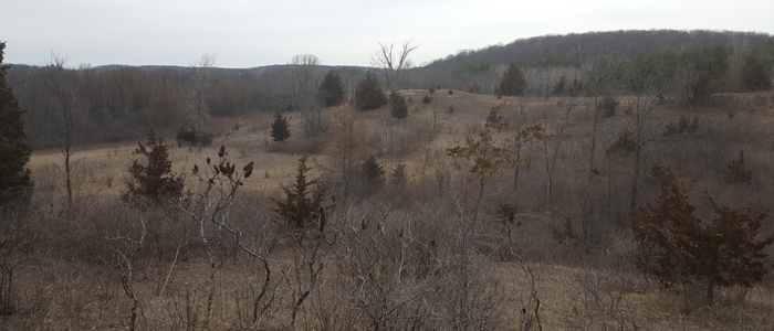
The LaBudde Creek Fishery Area contains lowland brush and swamp hardwoods adjacent to the stream. Northern hardwoods, upland brush, and grassland are present in the upland areas of the property.
There is a 20-acre dog training and trial area along the southern end of the property on Garton Road just east of State Hwy 67. This area offers a variety of dog training covers with a mix of open grassland, brush, and trees. About fifty (50) dog training and trialing permits are issued for this popular area every year.
LaBudde Creek Fishery Area is the site of a recently completed 3.5-mile-long segment of the Ice Age National Scenic Trail. The Ice Age Trail is a thousand-mile-long footpath that follows the terminal moraine of the Wisconsin Ice Age that stretches from Potawatomi State Park in Door County to Interstate State Park on the Wisconsin-Minnesota border. The trail highlights the glacial landscape that was sculpted by the last ice flows. These Ice Age remnants are considered to be some of the finest examples of continental glaciations in the world.
Location/Directions
LaBudde Creek Fishery Area is located in the Town of Rhine less than a mile east of the Village of Elkhart Lake in Sheboygan County. The property is bounded by County Hwy FF on the north, State Hwy 67 on the southwest, and Garton Road on the south, and is bisected by County Hwy A and Little Elkhart Lake Road.
Activities
Angling opportunities
With an average depth of 10 inches and a 6 to 8-foot width and mostly brushy shorelines, LaBudde Creek offers challenging wading fishing for Brook Trout using short flip-casting.
Recreational Opportunities
|
|
Contacts/Partners
For questions and comments contact:
Wildlife Biologist
Department of Natural Resources
1155 Pilgrim Road
Plymouth WI 53073
920-892-8756 ext. 3040
Fisheries Biologist
Department of Natural Resources
141 NW Barstow St, Room 180
Waukesha WI 53188
920-387-7873
Partners:
Ice Age Trail Alliance [exit DNR]
Sheboygan County Conservation Association [exit DNR]